Media Contact
Email: [email protected]
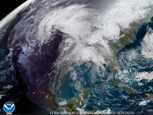
During the middle of March, a dire warning was widely broadcast regarding a severe winter storm system that was poised to strike the U.S. Midwest. In recent years, we have been presented with several sensational new weather catchphrases, such as ‘polar vortex’ and ‘bombogenesis’. The extreme weather warning of this week was also given a horrifyingly descriptive name: we were told that the thing bearing down on a huge portion of the U.S. was called a ‘bomb cyclone’.
It turns out that these terms are not new at all, and have been in use for some time in meteorological circles. Polar vortex, bombogenesis, and bomb cyclone are all actual meteorological terms that describe specific weather conditions. For example, the term bomb cyclone is also called explosive cyclogenesis, and describes an explosively strengthening storm that is capable of unleashing immense power and destruction. That power and destruction was inflicted on a large swath of the Rockies and Great Plains regions, from Nebraska all the way down to Texas.

A satellite image taken on March 13, 2019 shows a large storm system moving towards the eastern United States. GOES-East/NOAA
The storm itself was brutal. Interstates were shut down or blocked by debris, and transportation was all but impossible. The ferocity of the storm was unimaginable — an intense white-out blizzard made even more horrifying by hurricane-force winds — even a few tornadoes — all combined with frigid temperatures so low they were deadly in their own right. It was truly a worst case scenario!
Fortunately, the storm itself did not last long, and by some miracle there was only one fatality attributed to the blizzard. Immediately afterwards, however, a new threat gathered steam. All that snow and hail began to melt in the warmer spring weather that followed the bomb cyclone, and rivers and streams began to swell. Interstates once again became impassable, this time due to flooding rather than snow and ice.
Probably the worst-hit state was Nebraska, which suffered widespread transportation hazards; including sections of vital interstate highways closed, bridges washed out or damaged, and even a nuclear power plant reportedly under threat from encroaching floodwaters. The nuclear plant was later declared safe and operating at full steam, thanks to its advanced system of protective flood barriers. Still, more than half the counties in the state had been declared under a state of emergency, and citizens were urged to stay home if possible.
Throughout the affected region, historic floods devastated farms, homes, and businesses — with rivers cresting at 18′ or more. The states of Iowa and Michigan are also suffering from the aftermath of the bomb cyclone, and authorities continue to struggle with widespread flooding that may take weeks to recede. Although power has been largely restored, supply chains have been disrupted and goods and supplies are under-stocked in many areas.
Sadly, the farmers and ranchers that have already been struggling with other financial disasters will be the hardest hit by these unseasonal and unexpected floods. The massive flooding that has struck huge portions of this farm-dotted landscape has swept away livestock, barns, homes, fields, topsoil, and even expensive heavy equipment. For many farm families, these floods will inflict the final blow.
Source: FloodBarrierUSA
As government leaders debate climate change, officials and community leaders in cities across the U.S. are taking action to prepare for climate change impacts they believe are inevitable.
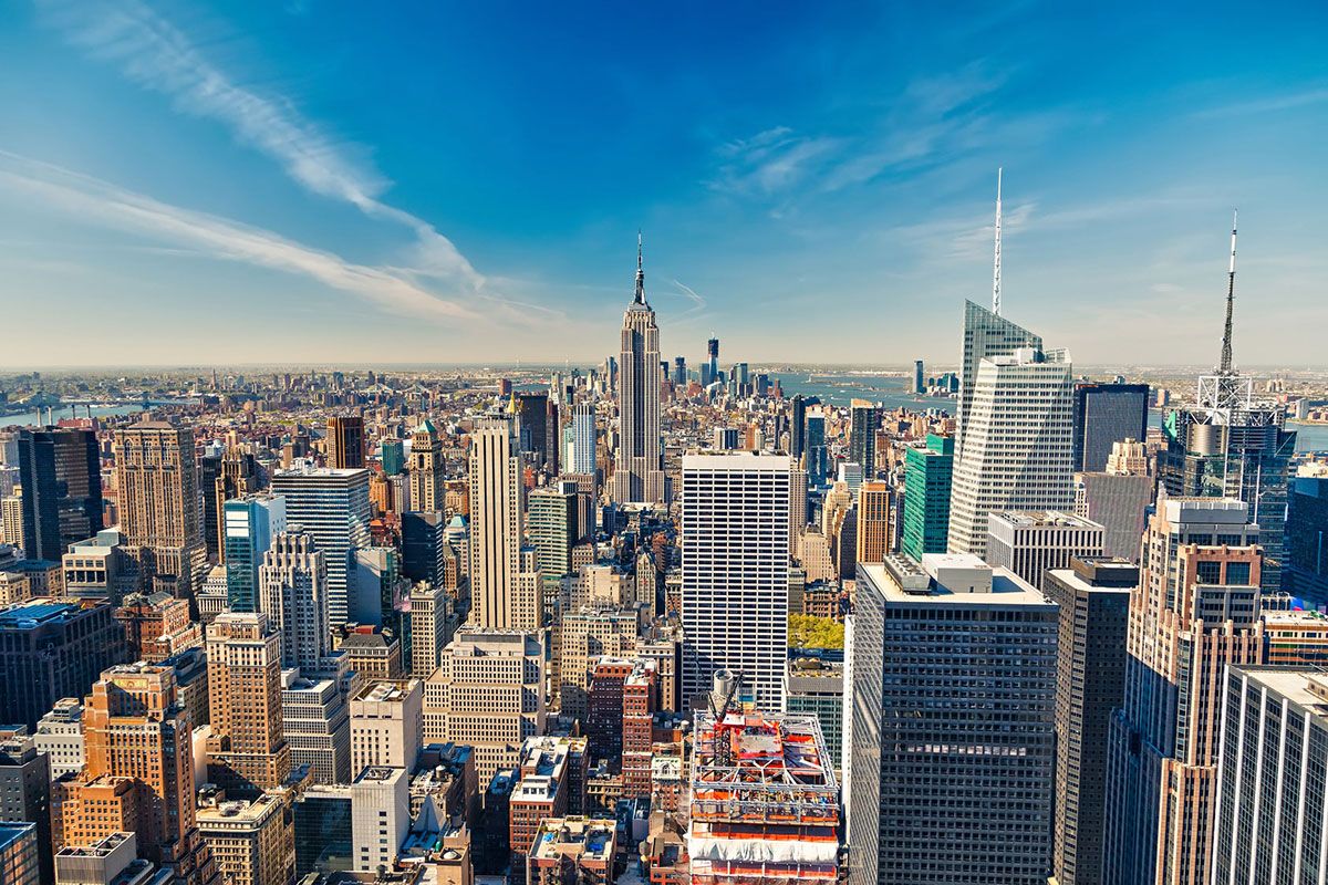
In March, New York City Mayor Bill de Blasio proposed a $10 billion plan to build out the Lower Manhattan coastline by as much as 500 feet to protect it from frequent flooding. The area, which includes Wall Street and the South Street Seaport, suffered $19 billion in damage in 2012 when storm surge from Hurricane Sandy flooded real estate, subways and other critical infrastructure.
de Blasio described the proposal as “part of an overall resiliency plan for Lower Manhattan that includes a $500 million project to fortify the area with U-shaped expanse of grassy berms and removable storm-barriers that can be anchored in place as storms approach.”
Detractors of the plan cite concerns about its impact on the marine habitat and coastal environment. Some feel it doesn’t go far enough to protect other parts of the city vulnerable to flooding. The plan also faces additional hurdles that include coordination with Congress, the U.S. Army Corps of Engineers and other entities that may hold it back. (For more about the plan, read the Bloomberg News story www.bloomberg.com/news/articles/2019-03-14/de-blasio-seeks-to-flood-proof-lower-manhattan-by-adding-land.)
Similar proposals by former NYC Mayor Mike Bloomberg and the NYC Economic Development Corporation’s federally-funded $30 million “RISE : NYC” competition have done little to improve the city’s resiliency so far.
David Levy, professor of Management, Director of the Center for Sustainable Enterprise and Regional Competitiveness, University of Massachusetts, warns “beware the big fix.” His team studied the feasibility of constructing a large barrier across Boston Harbor that would deploy large gates to protect the city from storms. The plan would cost the city an estimated $12 billion over 30 years. The study determined the high cost could not be justified in the face of uncertainty about sea-level rise and global warming.
According to Levy, most resiliency projects provide no immediate benefits and are hard to sell to the public. He recommends a “neighborhood-level approach” that includes “upgrades in housing, transportation and infrastructure.” Additionally, investment by private property owners in flood protection measures like flood gates and flood doors would lessen the public burden.
Some cities have taken steps in this direction. Last year, Miami voters approved a $400 million bond to pay for resiliency projects. In Harris County, Texas, voters still rebuilding after Hurricane Harvey approved $2.5 billion for flood protection. In San Francisco, a $425 million bond to shore up a sea wall was approved. (Read Levy’s article here, theconversation.com/climate-change-resilience-could-save-trillions-in-the-long-run-but-finding-billions-now-to-pay-for-it-is-the-hard-part-108143).
It’s not just major storms that threaten cities. Frequent nuisance flooding in Atlantic City, New Jersey and Annapolis, Maryland is taking an economic toll. According to a Stanford University study, Annapolis lost as much as $172,000 due to 3,000 missed customer visits in 2017 due to flooded businesses. (Read more here, www.bdcnetwork.com/persistent-flooding-having-economic-impact-coastal-cities.)
The most vulnerable cities seem to understand that the climate is changing and they are making efforts to prepare for what’s coming. Given the intensity of recent storms, the sooner the better.
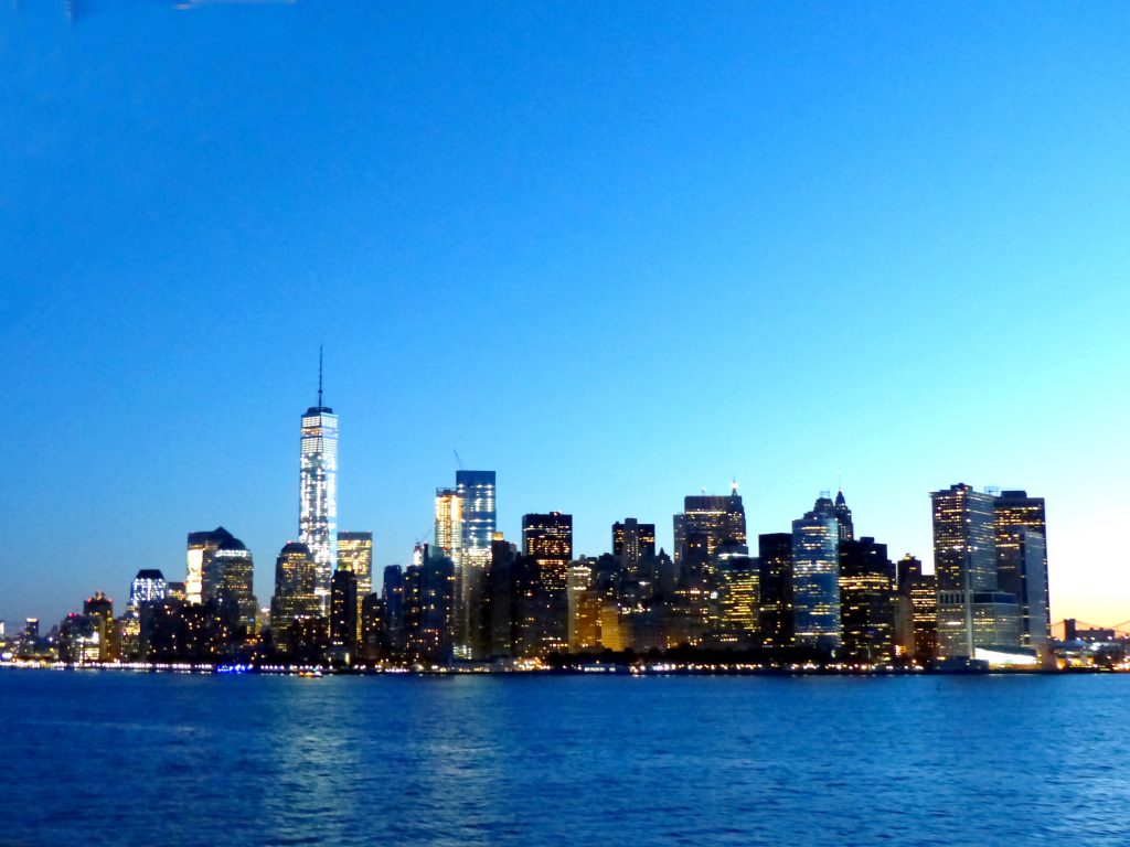
Photo credit: By Edgar El, CC BY 3.0, https://commons.wikimedia.org/w/index.php?curid=60246822

Scientists have learned that the glaciers of Greenland and Antarctica are melting far faster than previously suspected, creating a flooding hazard to coastal communities all over the world. It is now known that many glaciers that appear to be healthy and solid from above are in fact melting from within, below the surface. This subsurface rot is suddenly revealed when huge glacier formations suddenly fracture, revealing a large empty space beneath, where the ice has already melted. A good analogy is to think of a decayed tooth. The tooth may look and feel strong, but if a cavity lurks beneath the healthy enamel, it can eat away at the tooth from inside, until it one day breaks apart. This is currently happening to huge glaciers in various parts of the world.
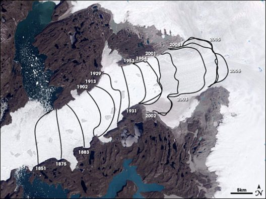
There is one place on earth that is causing the most concern regarding global warming in general and melting glaciers in particular. This is the great frozen island of Greenland, which is entirely covered by a huge ice sheet. For reasons not yet fully understood, the glacial ice sheet that covers Greenland is melting much faster than other glaciers. The melting and fracturing of massive glaciers in Antarctica has been reported in the news frequently, with alarming video of enormous icebergs calving and breaking apart. One glacier on the Larsen Sea Shelf calved a stupefyingly huge chunk in late 2018, and the iceberg that broke off was more than four times the size of Manhattan! As scary as this Antarctic melt truly is, the melt that is taking place in Greenland is even worse.
This Landsat data image shows how the Jakobshavn-Isbræ glacier retreated, from left to right, up the Ilulissat fjord between 1851 and 2006. Courtesy NASA Earth Observatory
But all this melting of glaciers and calving of icebergs is not causing hazards exclusively on a local basis. It is not only polar bears and walruses that will be negatively affected by this rapid melt. The freshwater that is pouring into our seas from the melted glaciers in Greenland is creating many, many other threats — up to our own front door, thousands of miles away. For example, the introduction of all this suddenly unlocked freshwater affects salinity, ocean currents, atmospheric conditions, and of course, sea level rise. All these factors affect much more than our oceans!
By the end of this century, it is expected that the planet will see a sea level rise of between half a meter and two meters, or perhaps even more. We have all seen the scary projected maps showing half of Florida swallowed by the sea, but unless we live on the Florida coastline, many of us still continue to underestimate the devastation that sea level rise will bring to all of us. In addition to losing millions of homes, farms, businesses, harbors, infrastructure, and even fisheries, sea level rise will also impact all of us by putting into motion the forces that create stronger and more frequent hurricanes, tornadoes, droughts, monsoons, and even wildfires. In short, we will all be affected, to some extent, by the glaciers melting in Greenland, no matter where we live.
While the worst of this dire future remains outside the life span of people alive today (and it is hoped that corrective measures may be able to reverse or slow the threats) some of these effects are already being felt today. Sea level rise is indisputably eating away at our coastal communities, and flooding is an ever greater threat with each year that goes by. Fortunately, great innovations in the area of flood defense are giving businesses and homeowners important flood-fighting weapons in the struggle against floods. Even as floods become more powerful and frequent, so the flood barriers are constantly being improved and adapted to stay one step ahead of the threat.
Source:: FloodBarrierUSA

A new article (https://www.popsci.com/sea-levels-rising-unevenly) recently published by Popular Science explains some quirks of sea level rise in a way that is easy for non-scientists to understand. The author, Marlene Cimons, uses a see-saw metaphor to help us to visualize the forces at work as changes in sea level affects the coastline differently in different areas.
The average lay person probably envisions sea level rise as a uniform phenomenon that simply increases the volume of the ocean, causing it to encroach the land masses equally all around the globe. But this is not how it happens in reality, and Ms. Cimon’s article helps us to understand why, as she describes the natural process that is called ‘post-glacial rebound’.
When a large glacier covers a land mass, the extreme weight of the huge ice feature weighs down the land under the glacier, but the ice-free edges are squeezed upwards. We can easily visualize this by thinking of the see-saw: when one side is down, the other side must go up. If we push on a water balloon, for example, the center of the ballon goes down but the edges go up. Over a long period of time the glacial ice has melted, and the weight has been lifted off the land. This results in the formerly weighed-down land springing back up, with the previously uplifted land sinking back down. Of course, none of this happens quickly, so in this sense the see-saw comparison is misleading. Even though the glaciers that once covered much of the northeastern U.S. have disappeared thousands of years ago, the land is today still see-sawing slowly in response to the changes created by the melting.
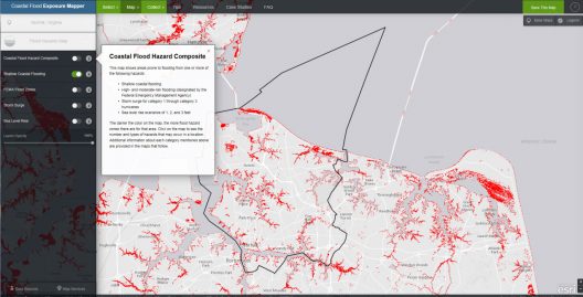
NOAA’s Coastal Flood Exposure Mapper is an online tool that allows the user to create and share maps of sea level rise and flooding, and view the potential populations impacted.
So in our present day we have land that is slowly rising in some places and slowly sinking in other places. This movement is not perceptible to us, and yet it is happening quickly enough that it can be measured during our lifetime. It is due to this post-glacial rebound that areas such as the Chesapeake Bay region are experiencing faster and more extreme sea level rise than an area that was not affected by glaciers. This region was historically located at the uplifted edges of a glacier during the distant past, and is now sinking, while simultaneously being inundated by sea level rise. These two factors, working together, make these areas of land much more likely to be inundated, because they are physically sinking at the same time that sea level rise is encroaching the entire coastline.
We now know with a high degree of certainty that this sea level rise is caused primarily by two things: the melting ice caps that are adding unfathomable amounts of fresh water into the oceans, and the warming of the oceans themselves, which physically expands the water. These forces, combined with the post-glacial settling of certain geographical areas, all work together to make it appear that some zones are being inundated at a much faster rate. These areas are today serving as canaries in the coal mine, and the alarming loss of land in these zones is perhaps waking up communities that are currently less affected.
With sea level rise speeding up measurably (and observably) even during one human lifetime, the need for flood defense and long-term planning has reached a critical status. Communities and municipalities that fail to learn from what is happening in Norfolk, Virginia will pay dearly in the near future. Zones that were formerly not known to flood will soon be suffering unspeakable flood damage and devastation if prudent measures are not put into place NOW.
Source: FloodBarrierUSA